Thursday, January 31, 2019

Escaping the Polar Vortex

We woke up to -31F in Brooklyn Park on the morning of January 30. A bit before noon we departed for the airport, and roughly 21 hours later we stepped out of a Boeing 767 at Rio de Janiero airport where the temperature was 36C (about 97F) — a change of about 128 degrees.
We feared the cold might have delayed our departure from Minneapolis. It did so, ever so slightly. The only real issue (aside from the plane being ice cold inside because the ground heaters couldn’t keep up) was that the catering trucks were frozen, so that the coffee and snacks couldn’t be loaded aboard. Someone went and got a bunch of bottled water and we took off for JFK. Our arrival was only 20 minutes or so behind schedule, and the plane had warmed up nicely once the engines were started.

JFK was another story. High winds had reduced the number of usable runways, backing things up. We were supposed to have had a 3 hour layover, but it turned into 5. Then the plane taxied over to the de-icing station and got in line. De-icing took forever, not only due to the number of planes lined up, but also due to the fact that the wind blew the antifreeze everywhere other than where the nozles were pointed.

We finally got into the air about 3 hours later than scheduled. It was a nice, new Boeing 767 and we had a pair of good seats (one aisle, one window) near the back of the plane, but Delta was having a bad day. Also, those seats seemed awfully close to the seats ahead of them, making it difficult to stretch out. Thanks to drugs and alcohol, however, I managed to pass out for nearly 5 hours. Mary did not fare as well.
Because we were so late to arrive, we were met by a car and driver, rather than the usual bus. All the others in the group had arrived well ahead of us. We met with our tour director briefly in the hotel lobby, then went to our room for some overdue showers and to change into some less wintry clothing. We did a bit of exploring of the hotel and environs on our own. Our hotel is right on Copacabana beach, only a block from the famous Copacabana Palace hotel. We have an outdoor pool on the 20th floor, and one of the world’s most famous beaches across the street.
Our group met for the first time for an orientation meeting at 4 p.m. Carolina, our Chilean tour director, seems more than competent, and the group of 20 introduced ourselves to one another. OAT groups are usually limited to 16, but groups for this tour are a bit larger due to some economics surrounding the small cruise ship we will be on later, when we explore the Chilean “fjords. The group appears it will be a good one — typical OAT, couples around 70, give or take, mostly retired educators of one sort or another..
After the meeting, Carolina took us on a brief walking tour of the immediate neighborhood, then to dinner. The typical Brazilian restaurant served a buffet of salads, vegetables and cheeses. Then waiters came around to the tables with various meats on large skewers, right off the fire. They would keep bringing meat until we begged them to stop, then they brought dessert and coffee.
We walked off some of the huge meal along the beach before turning in a bit early.

Monday, April 16, 2018

Reunions

On return to Las Vegas we got to spend one night at the home of our friends, the Orabka's. We have known them since our kids were small, and got together almost annually for many years. More recently, retirement took them to Las Vegas, where two of their three children live within blocks of them. It was fun to renew the friendship, however briefly.

The flight back to Kansas City was uneventful, and the weather at that end was far better than it had been when we started out. We spent one night there to touch base with the grandchildren one more time.

The next day we were off to Lincoln, Nebraska where we planned to spend a night with an old college buddy and his wife. From Lincoln we drove north to Fremont and the campus of Midland College (now Midland University), our alma mater, where we celebrated the 90th anniversary of the founding of the Midland Choir. Our greatly-respected and well-loved choral director from the 1970s was present (though nearly deaf in his mid-90s), as were a number of friends from college days.

Our plan had been to return to Fremont and the reunion on Saturday, but a winter storm (yes, in April) was moving in from the west with the threat of ice and snow. We left Lincoln mid-morning and escaped eastward to Des Moines, unfortunately skipping the rest of the festivities.

Time in Des Moines was spent helping my parents prepare for a transition from their home into a retirement community. There is significant accumulation of "stuff" that must be sorted, and much of it disposed with, in order to move from a three bedroom house to a one bedroom apartment. Sentimental attachments make the work painstaking.

Monday morning we were on the way homeward, anxious to meet our newest grandchild. She couldn't wait to be born after our return, but we got to see her at one week old. Because she came early, she is tiny. Her cousin, born two months earlier, started out well over 9 pounds. This little girl began just over 6 pounds. The difference is startling! But she is a big eater, and will undoubtedly catch up with him at some point.

After a couple days to rest and take care of various details (like our taxes), I will be heading back to Des Moines to continue helping my parents with their move. But there are no adventures on the horizon -- for a month or two.

Tuesday, April 10, 2018

Grand Canyon II

The morning began early for us due to the time change. Our bodies are still an hour ahead of Mountain Standard Time.

Just as we were about to leave the room for breakfast we received a text message from our son-in-law that our daughter was in labor. This is a couple weeks ahead of schedule, and we had instructed this baby to wait with her arrival until after our return from this trip. Babies, however, have a way of doing their own thing.

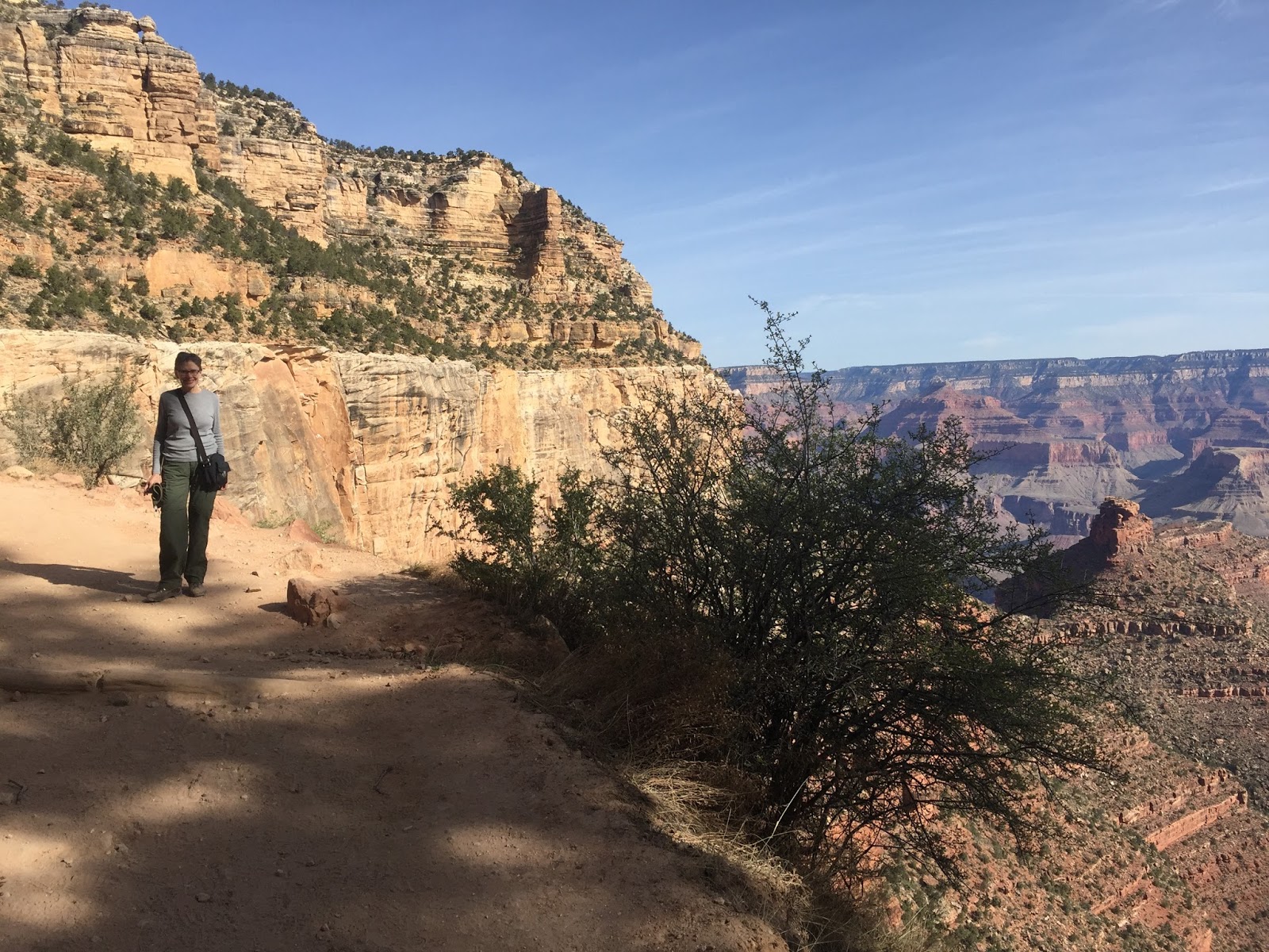
After breakfast we drove back into the national park and parked the car as near as we could to the Bright Angel Trailhead. This trail is the most popular below-the-rim hike in the park, and everything we had read suggested that it would be very crowded. However, because we got started early in the day, we found it less congested than Kaibab Trail had been yesterday. It’s all about the timing.

The Bright Angel Trail clearly gets more traffic, as there was less loose gravel on the way down. The quantity of fresh mule droppings was about equal, though. The morning was again bright and clear, and the early light made for spectacular views. There are only three waypoints on this trail: One at 1.5 miles, another at 3 miles, and a third quite near the canyon floor. We opted to go to the 1.5 point and then return. Despite the steep grade, we accomplished this in almost exactly 3 hours. Not bad.

Along the way we received a text message that our fourth grandchild, Clara Christine, had been born by caesarian section due to some complications. However, everyone was doing fine. Mary was so excited that she started telling total strangers on the trail about it.

After returning to the car briefly to change from hiking boots to shoes, and to pick up our lunch, we returned to the trailhead to catch the Red Line shuttle bus into the western rim of the canyon. Private vehicles are not permitted here (other than bicycles) so the shuttle is the only way to reach this end of the park.

Since shuttle buses run every 10 minutes or so, people stream off the bus at each view point, then get on again, en mass, 10 or 20 minutes later. The first stop gave us a panoramic view of the Village and the Bright Angel Trail segment we had just completed. The next stop gave us an entirely different view of the canyon.

The Bright Angel Trail we hiked as seen looking down from the Rim.
Guidebooks Mary had read suggested walking from the second to third, and from the third to fourth view points. We did the first walk, which was far back in the trees from the rim, and longer than it appeared on the map. After that, we decided we had had enough walking (we still totaled about 5.5 miles for the day).

We kept searching for a picnic table or bench on which to have our lunch, but didn’t find one. At the third bus stop, Powell Point, we finally gave up and sat on the stump of a dead pinion pine to eat. Had we walked just a bit father, to the point itself, we would have found two very nice benches. Such is life.

By the time we had reached the eighth overlook we were spent. There was only one bus stop left, Hermit’s Rest. When we got to it, we didn’t even get off the bus. Our legs just wouldn’t carry us. The ride back to the trailhead was long enough to allow us some recovery. And we even got to see some elk along the road on the way back.

After leaving the park, we had an hour’s drive to Williams. The motel here was quite a bit cheaper than near the park, and very nice. However, the outdoor pool and hot tub were not yet open for the season. Our tired legs could have used that hot tub. As a consolation, however, Williams has several brew pubs. One was having happy hour, where we enjoyed some very good beer at ridiculously low prices, and made a toast to Clara Christine .

Downtown Williams is old and very touristy. The main street is part of the iconic Route 66, and they make quite a deal of that. We had a very good Mexican meal at a very reasonable price before returning to the hotel.

Monday, April 9, 2018

Grand Canyon I

Our motel did not have a breakfast room, but instead had given us coupons for breakfast at the adjacent restaurant. The restaurant was clearly, as the motel itself, owned by the tribe. The design was modeled after a Navajo hogan, the decor was very tastefully done, but all Navajo artwork, and the staff were all native American. Our expectations were low, but as we entered I noted two officers of the tribal police force were having breakfast, which either meant the food was good or else free. Turned out to be the former.

The drive to Grand Canyon was just over an hour and a half with light traffic. As soon as we left the reservation the time changed back an hour, which made it even earlier. We could not have asked for a better day — clear blue sky, unlimited visibility, and a morning temperature around 50 degrees (rising to mid-60s as the day wore on).

Our first glimpse of the Colorado River canyons was still out in the national forest area, between the reservation and the national park. Our first view of the real Grand Canyon was just inside the park at the Desert View Lookout. The famous lookout tower was not yet open, and we really didn’t want to climb all those steps before using those same legs for hiking a steep trail below the rim, so we were quite content to take in the view from ground level. The canyon itself was breathtaking in the clear morning light. There were probably only a half dozen or so others at the lookout, a tiny handful compared to times when this park is really busy.
Stopping at several more overlooks along the south rim, we continued to enjoy the views. We also heard other visitors, once again, speaking a babel of languages — along with some variant accents of English that we knew had not originated in North America. This is the nation’s second most visited national park, and when many visitors come to the U.S., this is one of the places they most want to see. Now that I’ve seen it for the first time, I understand why.

We drove on to the main south rim Visitor Center and got an excellent parking place not far from the buildings. The huge parking lots were almost empty. We spent a little time in the Center getting oriented with the various maps and information boards, then we jumped onto a waiting Orange Line shuttle bus to retrace our drive in by a couple miles to the South Kaibab Trailhead — a place private vehicles are not allowed to go.
From the bus stop we walked about a quarter mile, past the pack mule corral (bad smells) to the actual trailhead, where we started down “below the rim.” We were definitely not alone on the trail, but neither was it as crowded as the trails at Zion or Bryce Canyon. In front of us for awhile was a group of about a half-dozen adults being led by a guide. Members of this group all had large backpacks and clearly were preparing for an overnight on the canyon floor, some 5000 feet below us. We would not be going that far.
One had to make the descent rather slowly, as the path was steep and there was lots of loose gravel. One also had to beware of mule droppings, which were abundant. We were probably only a few hundred yards down when we came face-to-face with the mules themselves. Two rangers had taken a string of mules down the trail loaded with fill dirt and gravel for a team of national park employees who were making repairs to the trail. I’m certain the mules were happy to have been relieved of their loads before the trip back up to the top. They were moving pretty fast, and all we could do on the narrow trail was to make ourselves small and get out of their way.
We continued as far as “Ooh-Aah Point” a bit less than a mile along the trail. Knowing that what goes down must come up, we decided it would be prudent to turn around and begin our ascent. Despite the steep grade and nearly 7000 foot elevation, it wasn’t as bad as we had feared. We completed the nearly 3 mile round trip in just about 2 hours exactly. Not bad for old folks!

The Orange Line shuttle bus picked us up in short order and took us back to the Visitor Center, but we did not get off there. We continued westward with the same bus and driver to Yavapai Point, where we visited a small geology museum. After viewing the exhibits explaining how the Colorado River has acted as “liquid sandpaper” for the last 5 million years to carve the canyon, we enjoyed our peanut butter sandwiches on a bench outside with a gorgeous canyon view.

From there we walked the Rim Trail — which is really a flat, crowded, asphalt sidewalk — back to the Visitor Center once again. To get a few minutes rest, we watched the 20 minute film about the canyon. Then it was back to the shuttle buses, a Blue Line bus this time, westward as far as Hermit’s Rest Transfer Point, which is the trailhead for the Bright Angel Trail — one of the earliest and most famous below-the-rim trails.

No more of that today! Instead we did more Rim Trail in this western area, around and through the century-old buildings of the original Grand Canyon Village. After seeing what there was to see of this historic area, we found another (very crowded) Blue Line bus back to the Visitor Center once again. This time, after a 7 mile day, we decided we’d had enough and got to the car, setting off to find our motel.

Finding the motel was not as easy as it should have been, because it is set back from the road and has very poor signage. They could use a communication studies professor as a consultant! Once checked in, however, the room was nice. We enjoyed a very good (if pricey) Mexican meal at a nearby restaurant, relaxed a bit in the hot tub, then fought to stay awake until a reasonable hour.

Sunday, April 8, 2018

Monument Valley

Emerging from our motel room this morning we discovered a strange liquid substance clinging to our car, and to all other vehicles in the parking lot. Water. It rained in the desert! We don’t know exactly how much — not a lot by Minnesota or Iowa standards, but measurable.

This turned out to be a huge advantage for us. After breakfast we drove down to the Navajo Nation, which begins just north of the Arizona state line. After paying our entrance fee (National Park passes don’t work on the reservation) we continued to the Visitors Center to get info on hiking paths. There are few in this section, but a nice, four-mile loop called Wildcat Trail begins here and takes the hiker around West Mitten Butte.

Getting down into the valley floor from the Visitors Center was the hardest part. The trail was steep, very sandy, and not particularly well marked. Once down on the floor, the trail was flat and easy to follow. Jackets and shirts that had been necessary on top quickly came off. The temperature was only in the high 60s, but the whipping wind in the parking lot completely disappeared, and there was absolutely nothing to block the sun. In summer, the hiker who comes later in the day or without water could be in big trouble.

The morning rain left the surface just moist enough to keep the sand and dust from blowing around. There were a few muddy spots, but all in all, it was good to have the moisture in the ground to keep the path firm underfoot.

It was surprising to find a house trailer and a couple of huts on the other side of the butte. The parks we’ve been in cause us to forget that people actually live here. The rock formations are fascinating and there is beauty to the landscape (John Wayne filmed his first big hit Western movie here in 1938, and many more motion pictures and TV shoot-em-ups followed). But this is a godforsaken climate. There are no trees. Even the sagebrush looks a little sickly. Water has to be trucked in for people and animals.

The path back up to the Visitors Center seemed even more steep going up than it had been coming down, though this time we knew where we were going. As soon as we got back we jumped in the car for a longer exploration of the valley via a loop road. The signs warned that road conditions can vary, and that we drove at our own risk. But we had just been on a hiking trail where surface conditions were nearly ideal, so we assumed this sign was meant for other times of the year.

Wrong. This road was terrible. Rural gravel roads in Iowa look like interstates compared to this. It was steep, badly rutted, full of potholes, and generally rough all the way. The speed limit was marked at 15 mph, and there were some big Jeeps and other all-wheel drive pickups and SUVs that could actually go that fast. A compact passenger car could not. Fortunately, there were few vehicles of any sort out there, so we weren’t holding up traffic.

Upon return to the Visitors Center we took some time to visit the small museum. The room devoted to the Navajo “Code Talkers” of World War II was particularly interesting. We also walked around an outdoor exhibit of traditional Navajo dwellings, or hogans. The tribe could really do something great with this as a living history type of thing, showing how the various crafts are done and explaining the culture. But there aren’t even signs here to explain the different types of construction. Very disappointing.

We left the Valley, but not the reservation, as we continued our drive southwest toward the Grand Canyon area, where will be tomorrow. The tribal lands are some of the most empty, desolate areas we have seen. The poverty depicted by the tiny settlements is difficult to imagine. It also contrasts with the community where we are staying tonight, Tuba City, AZ. The motel we are in is owned and operated by the Navajo Nation, and the entire staff is native American. It’s one of the nicest (and most expensive) places we’ve stayed on the trip.

Interesting side note: Utah is on Mountain Daylight Time. Arizona does not believe in daylight savings time, so is on Mountain Standard Time. However, the Navajo Nation overlaps both states and has determined that the reservation will follow Utah, even though the larger share of it is in Arizona. Thus, the part of Arizona that is Indian land is in a different time zone than the rest of the State of Arizona. When we return to Nevada, we will be on Pacific Daylight Time, but that is the same as Mountain Standard, so we only change our watches when we leave the Navajo Nation. Confused?

Saturday, April 7, 2018

Dead Horse

For our final day in the Moab area we drove to Dead Horse Point State Park. Our U.S. National Parks  “senior passes” aren’t good at a Utah state park, of course, but with the “senior discount” our entry fee was only $10 for the vehicle and both of us in it. A bargain.

We parked at the Visitors Center, which had not yet opened for the day when we arrived, and walked the East Rim Trail back toward the north (the direction from which we had driven in) to the Colorado River Overlook. The trail was very easy — flat and exceptionally well marked.

I don’t know if this trail was farther back from the rim than the trail we walked yesterday, or if it was that these cliffs drop “merely” a thousand feet (rather than 1400 feet), or if I was just getting used to it. In any case, I was less nervous about being along the rim of the canyon today.

We retraced our steps back to the Visitors Center and spoke briefly with a DNR ranger about options. We elected to continue the East Rim Trail southward to Dead Horse Point and back again for a 3 mile round trip. In fact, when we reached Dead Horse Point we continued onto the West Rim Trail for a time, until the two trails were just across the road from each other at a narrow point called “The Neck.” Then we crossed and rejoined the East Rim Trail for the trip back. Thus, our hike was actually a bit longer than planned.

Interestingly, these trails are named backwards. The East Rim Trail is really on the west rim of the canyon, and the West Rim Trail is really on the eastern rim. However, with respect to the mesa on which the trails are built, the East Rim Trail is on the east side, and the West Rim Trail is on the west side. Confusing? Yes.

The fact that there are hiking trails here at all is perhaps amazing. What this park is really all about is mountain bikes, and there are miles of bike trails here. There were also hundreds of mountain bikers here to enjoy them. A big mountain bike rally was taking place just outside of Moab. This wasn’t part of it, but it seemed that every mountain biker who wanted to escape the rally had come here.

After our hike, we drove back toward Moab but took a detour onto a state highway marked as a Utah Scenic Byway. It was a pretty drive along the Colorado River, on one side of the road, with stone cliffs on the other side.

The first feature we noted were rock climbers — dozens of them, hanging from ropes just above the highway, while instructors, coaches, and friends stood right next to the traffic holding safety lines. This is a prime spot for rock climbing instruction.

Amid the rock climbers were signs pointing to “Indian Writing.” We pulled over and got out of the car, and immediately saw, on the rock face just above us, hundreds of petroglyphs. A placard placed by the state Archaeological Society explained that these areas of rock had been easily accessible until the road was built, removing gravel and soil along the cliffs. It also pointed out that some of these had been dated to nearly 2500 years ago!

Returning to Moab, we decided that the day was so pleasant that we would like to sit outside somewhere and enjoy a cool beverage. Outdoor venues are apparently rare in Moab, partly because all of the businesses line the main highway and the noise of the trucks and other traffic makes for a less than ideal experience. We also discovered that, because of some state law or just bad policy, one can’t sit and have a beer in a restaurant here without ordering food. We had already eaten, and the lunch rush was well past leaving plenty of empty tables, but we got kicked out. We had to go to a licensed bar to have a drink, so we returned to the local brewery. Alas, no outdoor seating.

The drive for the day was to Blanding, UT. This little town has little to offer other than cheaper lodging outside the tourist zone, and a head start on our drive to the Monument Valley. Two surprises here: A very nice, new Visitors Center had an interesting little museum on the town’s history, and Pop’s Burritos (a locally-owned version of Chipotle) makes a very good meal.

Although it’s Saturday night, there isn’t much danger in getting into trouble here. The largest building in town other than the local high school is the Mormon church, and there isn’t a bar or dance hall to be seen. It’s a quiet place.

Friday, April 6, 2018

Canyonlands

After a good night’s sleep (no surprise after so little sleep the night before) we were ready for the day.  Unfortunately, this was one of the few hotels we booked on this trip not to include breakfast, and finding our first choice unexpectedly closed caused a short-term breakfast crisis.

That solved, we were off to Canyonlands National Park about 35 miles outside of Moab. The scenery on the way, and even on the road within the park early on, gives no hint of what will suddenly appear. A few scenic overlooks later, we were awestruck. At least first thing in the morning, we had no crowds to contend with. Our first hike was the first of the trip where we found ourselves alone on the trail.

That first hike was a short one to Mesa Arch. There were lots of signs by various plants and trees along the way, providing good information on the species and how it is adapted to the desert climate. Unfortunately, this sort of information seldom sticks, and when I come to the next bush I can’t recall whether it’s a juniper or a joshua. The arch itself was pretty cool, as well.
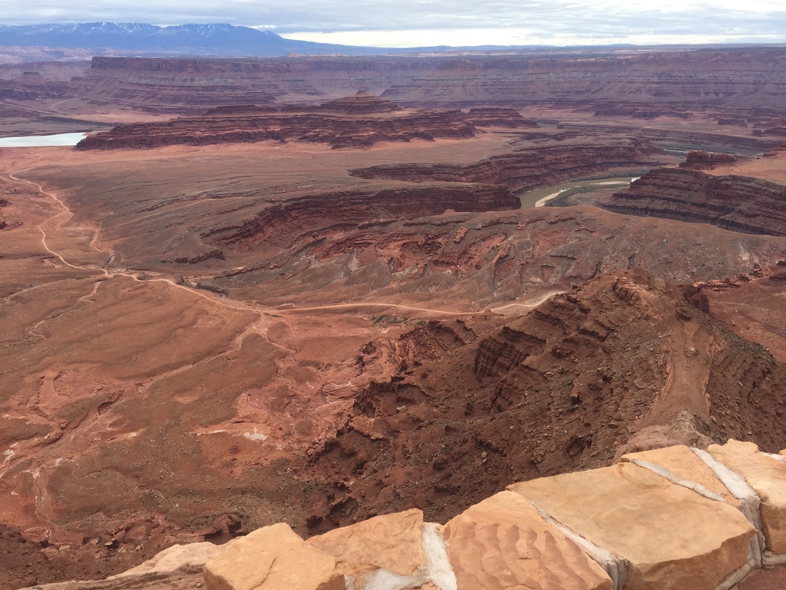
Fearing that the hordes would soon be descending upon the park after sleeping late in Moab, we decided to drive to the far end of the park road to take in one of the most popular hikes in the park before it became overwhelmed.

The Grand View Point Trail is described as “stunning” in the brochures. That’s pretty accurate. It’s an out and back, four miles total, and pretty flat. But it’s along the rim of the confluence of two canyons, with sheer cliffs of 1400 feet on either side. Fortunately, the trail is back from the edge a good 20-30 feet in most spots, and very well marked. But it’s still pretty eerie to look out knowing you are that far up with no railing, safety harness, or parachute!

At the point, one has to scramble up some pretty steep rock to get the whole panorama. I made it, but Mary elected the safer, and at our age probably more reasonable alternative of looking first one way and then turning around to look the other.

We drove back to an area known as “Upheaval Dome” and had our lunch in the picnic area near the parking lot. Geologists aren’t quite certain what the “upheaval” was that created this feature, but the prevailing theory is that it is an ancient meteor impact crater. In any case, it’s a pretty deep hole some 2 miles in diameter.

We set out for the First Overlook, which despite some climbing upward on steps was a pretty easy three-quarters of a mile. We planned to continue on to the Second Outlook, but the trail was largely across wide expanses of slickrock supposedly marked with little piles of stones, called cairns. But every little kid who can find three or more good, flat rocks can make a cairn, and many find it great fun to do so — whether along the trail or elsewhere. So we found the trail very poorly marked and eventually gave up and turned back, although we were fairly close.

By this time our options for fairly short hikes in Canyonlands were exhausted, and we weren’t prepared to take on a long, back country excursion. So we elected to drive back to Arches National Park (not out of the way, we had to drive right past it anyway) and complete the one hike that we hadn’t had the energy for the previous day.

The Park Avenue Trail is rated “moderate” in difficulty because of a few spots of rough terrain, but mostly for the steep descent into the canyon and the steep climb back out again. It’s an out and back trail, two miles total hiking. Views of the canyon walls on either side are quite striking. There were more people at Arches, so we no longer had the trail to ourselves, as at Canyonlands, but it was worth going back for.

Dinner was at a Thai restaurant just a block from our hotel, so we did a bit more walking. The place had rave reviews on Trip Advisor, but the people writing the reviews were overly generous. It wasn’t bad, but it wasn’t Thailand.